Push the boundaries of Pinecrest.
A hike will lead you to an unbelievable experience.
-
South Shore Rock
This hike is to the top of the South Shore Rock, the prominent rock that runs up to the top of the ridge on the south side of Pinecrest Lake. Link to Hike
-

Blue Canyon
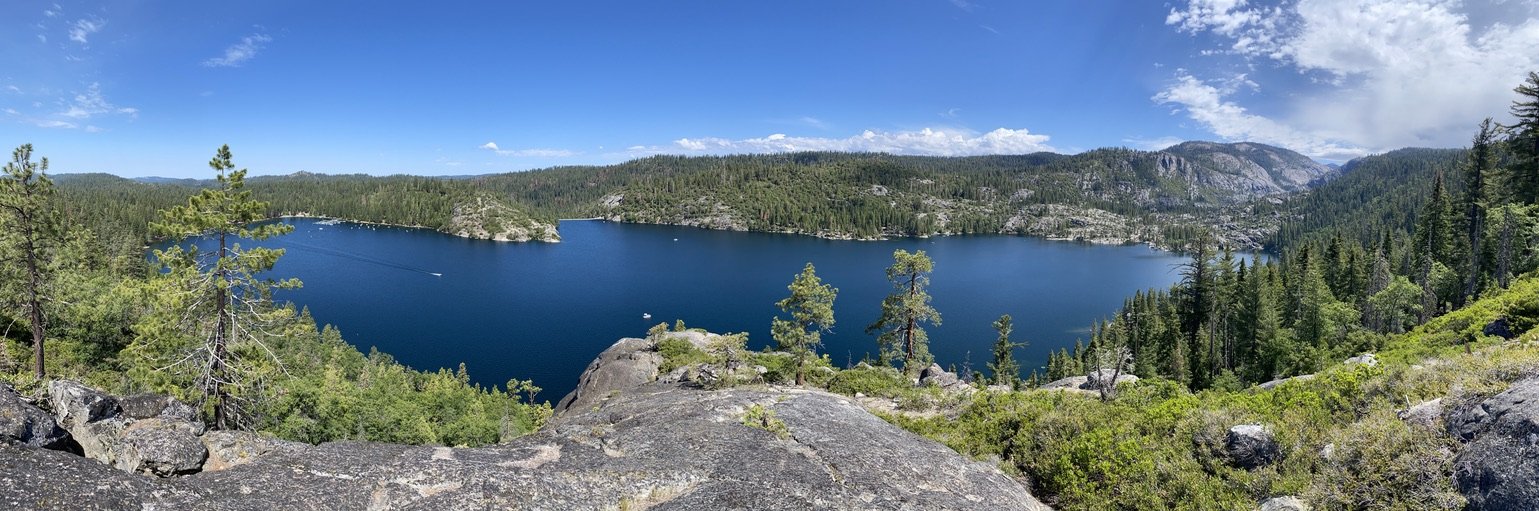
This is a cross country hike up a canyon near Sonora Pass to two beautiful lakes. Link to Hike
-

Three Chimneys
This hike is fairly difficult, but short hike to the top of the ridge near Three Chimneys. Link to Hike
-

East of Frankenstein's Bluff
This is a difficult, but fairly short, cross-country hike that delivers great views of Pinecrest Lake and the canyon above the lake. Link to hike.
-

Frankenstein's Bluff
This is a very short and easy hike that affords one a great view of Pinecrest Lake. Link to hike.
-

Bell Creek Crosscountry
This hike is a pretty hike along a creek and through meadows and forests. It is about five miles in length. To get to the starting point of the hike, one should drive up Dodge Ridge Road to the beginning of the loop road at the ski area. Link to hike.
-

Catfish Lake - Strawberry
The hike begins at the Pinecrest Marina. One hikes along the lakeshore trail to the dam. At the east end of the dam, one has a choice. Link to hike.
-

Cleo's
This hike is a cross-country hike from Pinecrest Lake to the north side of Cleo’s Bath. It is quieter and much less crowded than the normal route, which goes up the south side of the Stanislaus River. Link to Hike.
-

East of Donnell
This hike is a down-and-back hike with lots of granite. It is a cross-country hike (i.e. there are no trails). Most of the hike is on a granite ramp that goes from just below Highway 108 down to the upper end of Donnell Lake. Link to hike.
-

Hackenbush Ridge Hike
This hike climbs the infamous Hackenbush Ridge. The hike is best done as a one-way hike, and can be started from either end. Link to hike.
-

Chain Links Bump
The destination of this hike is the top of the granite bump to the east of Chain Lakes. This bump can be hiked to from Crabtree Camp, which is not far by road from Pinecrest, but this hike is a very long one. Link to hike.
-

North of Burst Rock
This document contains descriptions of several crosscountry routes in the granite north of Burst Rock. To get to the trailhead, one should drive up Dodge Ridge Road, turn right at the Dodge Ridge sign, and continue about half a mile to Crabtree Road. Link to hike
-

Waterhouse
This hike is somewhat demanding although
not very long. It takes the hiker
into the South Fork Canyon four miles
east of Pinecrest Lake. Link to hike. -

West Fork Cherry Creek
This hike goes into a beautiful
granite canyon, the canyon of the
West Fork of Cherry Creek.
The drive to the trailhead takes
more than an hour from Pinecrest.
One must use a National Forest Service
map to find the right roads to follow.
Link to hike. -

The Pythagorean Hike
This is a very difficult scramble
up the north side of Pinecrest Peak.
At the top one is rewarded with great
views of Pinecrest Lake and the Sierras
to the north. Link to Hike
-

Leavitt Peak
This hike takes one from Sonora Pass to the top of Leavitt Peak, the tallest mountain in the Emigrant Wilderness with an elevation of 11,573 feet. Link to Hike
-

South of Burst Rock
Headed South this time …. Link to Hike